Posts

Showing posts from January, 2024

Kaloko-Honokohau National Historical Park

Image
 We checked out of our airbnb and drove over the Saddle Road to Kona.   Since we had some time before we could check in to our hotel, we stopped at the Kaloko-Honokohau National Historical Park.  This seems to be mainly interested in preserving the way that Hawaiians developed to live off the land.  It consists of a fish trap and a fish pond (well two fish ponds, but we only saw one). The fish trap came first.  The idea of a fish trap is to create a pond where the fish enter during high tide but as the tide goes out, they are channeled thru only a small number of openings, which they can be caught easily.  This worked well and provided a good supply of fish for the people. But over time, they realized that rather than just catching the fish, they could put them in a much larger fish pond, and let them grow to be bigger fish, then catch them.  So they built larger fish pond structures which worked like the fish trap, but allowed them to farm the fish un...

The Pacific Tsunami Museum and Ken’s House of Pancakes

 In driving thru Hilo a couple of times, I noticed a building with the title Pacific Tsunami Museum on it, and figured that might be interesting.  We tried to go a previous night, but it was closed for a private event,  so we figured now would be a good time.  That turned out to be too naive, when we got there, we were told they were closing early and we only had 40 minutes before they closed.  But we looked around and got the gist of it. Tsunami’s are typically caused by earthquakes along a coast and cause very long wavelength waves to propagate in all directions. Since Hawaii sort of sits in the middle of the Pacific, it turns out an earthquake anywhere around the Pacific Ocean coast can cause a tsunami in Hawaii (and other places too, but the focus here in Hawaii is Hawaii).  Hilo has been hit by a number of tsunamis, from earthquakes in Chili, Russia, Japan, Alaska, and more. The waves are really interesting.  Most normal waves have a relatively sh...

Back to the Volcano, one last time

Image
We have done several hikes in and around Volcanoes National Park but we have not hiked the crater rim trail itself much.  So we thought we would go back to the park one more time and hike that trail.  Well, not all the trail, since it is quite long.  But we could start at one end, hike until we were tired, or got to a part that we had already hiked, then go to the other end and hike back from there. So we started by going to the end of the Crater Rim Drive - West and going to Uekahuna which is the highest point on the crater rim.  We hiked back towards the Visitor’s Center about a mile and a half.  That got us quite close to the crater rim in several places.  It’s difficult to tell by looking over the edge, but if you look a bit to your left or right, you can see that the crater rim just falls off almost vertically. which is why the trail stays well back from the actual rim most of the way. The mile and a half hike got us back to the steam vents, and Sulphu...

A Day at the Beach

Image
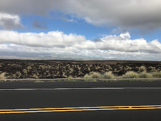
 We decided to go to a beach.  Not a black sand beach, or a green sand beach, or a lava beach, but just a plain white sand Hawaiian beach like the advertisements.  But there are none in the South East corner of the Big Island, so we drove over to the North West corner. We drove across the Saddle Road, between Mauna Loa and Mauna Kea, but instead of turning South on 190 to go to Kona, we went North, thru Waikoloa Village to the coast.   We noticed as we drove towards the coast that the land was mostly lava, but older rocks, broken up by scrub brush, not obvious lava flows. As we drove towards the coast, we saw a massive solar farm.  Just row after row of solar panels all pointing to the rising sun in the East. When we came back, we noticed that the panels had all rotated (well, all except for a handful whose motors are apparently broken) so that they pointed to the afternoon sun in the West.  So this was not just passive panels panels placed out in the sun, ...

Back to Volcanoes National Park

Image
Linda found a couple more trails in the Volcanoes National Park that looked interesting, so we drove back up there again. We had been up once to look around, and another time to walk across the Kilauea Ike Crater. This time we tried to climb down and walk across the Kilauea caldera itself.  The two caldera (craters) are separated by Byron Ledge. There is a trail to hike down to and across the Kilauea Ike Crater, and it turns out there is a separate trail (the Halema’uma’u trail) which takes you down into the Kilauea Crater itself. The trail starts out pretty normal, but with more caution notices. But there was clearly a lot of work done to create this path. Some of the difficulties with the trail are the unstable nature of the crater itself.  It is the most active on the island.  Nothing much is going on now, but there are occasional earthquakes, which can cause the crater rim to shift, and cause rock slides that can cover the old trails and they have to be rebuilt or shi...

Going North — Puukohola Heiau and the Waipio Valley

Image
 We have been over most of the South, West, and East parts of the Big Island, but that still leaves the North.  So we went North.  We drove up Highway 19 from Hilo, along the East Coast and then over to Waimea in the middle of the island and then over to the West Coast. The North part of the island is older and so the lava is more weathered and there is more dirt than in the South. It is much better for agriculture.  In fact we saw several fields with cows roaming around in them. This even plays into some of the history of the island.  Back in the 1700s the islands all had their own chiefs; the Big Island had several.  Including two, Kamehameha in the North, and Keoua in the South.  They were cousins, and rival chiefs. The Puukohola Heiau National Historic Site is the site of a temple (Heiau) that Kamehameha built to fulfill part of a prophecy that he would rule over all of Hawaii if he built a temple there and dedicated it to the war god Ku.  He ...

Hawaii Tropical Bioreserve & Garden

Image
 Linda really liked the snorkeling yesterday.  We could do it again, but the snorkeling is all on the West coast of the Big Island.  So that would mean a long drive over and back.  Plus the next snorkeling is swimming with Manta Rays and that is at night, so it would be even later.   But we decided it would still be fun, and if we did it on Monday, before our flight back on Tuesday, we could just drive over to Kona, do the snorkeling and then fly out the next morning, if we could find a place to stay Monday night.  So we spent the morning trying to find a place to stay in Kona.  I looked for places earlier, but they were all very expensive.  The hope is that since Monday is less than a week away, some place will be getting antsy about not having it rented, and be willing to drop the price to get an occupant. So we tried Kayak, and Expedia, and Booking.com, and finally Priceline.  Priceline was able to come up with one other “one of the follow...

Snorkeling at Captain Cook

Image
 Captain Cook is a place over near Kona, on the West side of the Big Island.  Linda wanted to go snorkeling again, and all the snorkeling trips seem to be on the West side.  I suspect it has to do with the trade winds — the North and East side of the island get stronger winds and currents. Of course it is a two hour trip over to the West coast, so we started out this morning around 10, getting to Kona around 12:30, taking the Saddle Road across the middle of the island.  We had lunch and then went down to wait for the cruise, which started around 1:45.  The cruise was on a catamaran. There were about twenty people on the cruise, plus a crew of 3.  We took off around 2:00.  The boat went out about a mile or so and down the coast to the Captain Cook Monument. This is in a relatively secluded cove where the water was shallow and much calmer.  The Captain Cook Monument is very difficult to get to; it is down at water level off a steep cliff. We snorke...

A Day Off

Image
 Nothing planned for today.  We went out and got a cup of coffee for Linda and a newspaper for me.  After breakfast — back at our place — I read the paper and Linda napped.  Then around noon, we went out to Target in Hilo. I wear glasses to see far away clearly, so particularly when I’m driving.  Linda wears glasses to read, reading glasses.  When we left home, she brought two pair of reading glasses along.  But somehow when we flew from Oahu to the Big Island, one pair disappeared.  Probably when we went thru security.  The same thing happened when we flew out of Kathmandu last year. And then yesterday, her second pair just broke, one arm just detached from the frames. So we went out and got another pair at Target.  We will see it that lasts for another week plus until we get home.  And while we were there, looked for another tube of toothpaste and random stuff. Then we went into Hilo to a restaurant Pineapples Island Fresh Cuisine...

The Green Sand Beach

Image
Hawaii is famous for its beaches.  The standard white sand beach.  The black sand beaches.  And it has a green sand beach.  The green sand is olivine crystals, washed out of the lava over time.  The beach sand is a combination of white sand (from shells) and black sand (from lava), and the green olivine crystals, so although it looks “sort of” green, it’s really just maybe a green tint. But it is still very rare to have enough olivine to make a difference, so we decided to go see it.    The beach is near South Point, the southernmost point of the Big Island, and of the United States.  To get there requires a fair amount of driving.  Along the way, you can see a set of wind turbines being used to generate power for Hawaii. Because South Point is really windy! And the roads don’t take you to the green sand beach, just close.  Then it is a hike from the end of the road parking lot.  We got there about 12:30, and set off on our hike. I ...